 From the bus stop on the
main road walk to the centre of the village, taking the path which starts at a
gate in the bottom right hand corner. Keep
ahead at the first junction of paths.
From the bus stop on the
main road walk to the centre of the village, taking the path which starts at a
gate in the bottom right hand corner. Keep
ahead at the first junction of paths.Walk
2 KISDON GORGE - KELD TO GUNNERSIDE
Upper Swaledale contains
some of the most hauntingly beautiful countryside of the Yorkshire Dales.
Kisdon Hill and the narrow gorge of the Upper Swale dominates the start
of this spectacular walk, which, below Muker, follows the river through some
typical herb rich ancient meadows, to the old Viking and later lead mining
settlement of Gunnerside. Please
walk in single file through these meadows to minimise damage.
Distance:
6 miles – 9 kilometres
Time:
Allow 3-3½ hours
Maps:
OS Explorer Map OL30 or Harvey Dales North.
Refreshments:
Café in Keld; Café, Pub in Muker (800 metres from route), Café, pub in
Gunnerside
Toilets:
Keld, Muker, Gunnerside
Getting
there:
Take the service 30 bus
from Richmond Market Place to Keld which leaves at
0900
on Mondays to Saturdays. Travel time to Keld
is approx. 1 hour.
On Summer Sundays and Bank Holidays Northern Dalesman
service 830 also runs to Keld.
Coming
back:
Buses leave Gunnerside
Bridge for Richmond on Mondays to Saturdays
at 1342 (during winter months book with driver on outward journey) and 1652.
Emergency
taxi back-up: Phone 01748 825 112 or
822 269
NB
for stronger walkers – suggest combining
Walks 2 and 3 to create a 19km (12 mile) walk with well timed later bus back
from Reeth – see Walk 3.
Drivers:
Park in Gunnerside (Bridge parking area) no later than 40 minutes after
the above times to catch the bus to Keld/Thwaite returning to your parked
vehicle at the end of the walk.
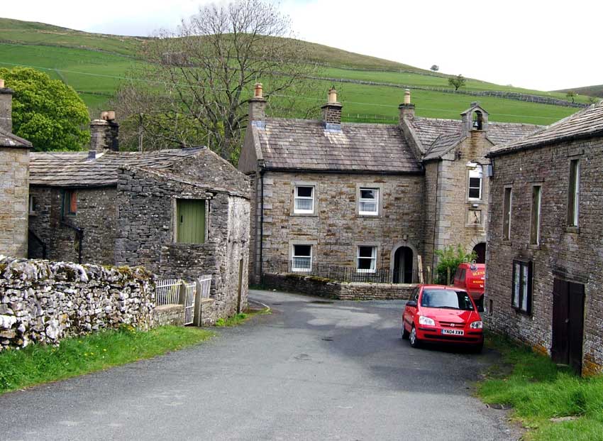
Directions:
From the bus stop on the
main road walk to the centre of the village, taking the path which starts at a
gate in the bottom right hand corner. Keep
ahead at the first junction of paths.
After some 200 metres
beyond this junction, a narrow path signed Upper Falls is reached.
This is an extraordinarily beautiful path, but steep and only suitable
for the agile – with the occasional fallen tree.
It leads down the steep hillside to cliffs above the Upper and Middle
Fall, a magnificent viewpoint, dominated by woods waterfalls and limestone
scars, but requiring the greatest care. Unless you are scrambling down to the
falls, the path (not a right of way), continues along and up the hillside to
rejoin the main path. If you are nervous or not especially agile, and choose to
stay on the main path, keep left at the junction with the Pennine Way some 100
metres further along the path, soon rejoining the narrow path from the Falls.
This is now a particularly
lovely way along Kisdon Side, along a lovely hillside, with fine views across
the valley towards Crackpot Hall and Swinner Gill, the remains of lead mining
and working across along hillside opposite. At one point the path is a narrow,
ancient way enclosed by trees, passing old barns, gradually descending the
hillside to become a path through meadows. At a junction of paths, take the path
left, marked by gated stiles, which eventually crosses to the riverside and the
footbridge.
If you wish to visit the
delightful village of Muker, take the stile on the right before the bridge
approach, which leads to a path across lush meadows – about 800 metres or 15
minutes walk.  Return the same way
to the footbridge.
Return the same way
to the footbridge.
Cross the bridge, itself a
good viewpoint up the Dale, with the massive shape of Kisdon hill dominating the
view to the left, a glacially carved hill isolated between old and new river
valleys. Turn sharp right along the well waymarked path through the edge of the
wood, which soon crosses meadows and stiles below Ramps Holme Farm.
Follow the main path, fairly clear on the ground, across fields,
gradually edging towards the riverside, and a lovely riverside path, including a
recently built section around a badly eroded slops below a woodland, before
eventually emerging at Ivelet Bridge, a beautifully arched Dales packhorse
bridge. This was on the old Corpse Road from Upper Swaledale to where, in
medieval times, there was the only piece of consecrated ground at Grinton
Church. There is still a stone by the bridge on which coffin bearers rested the
heavy coffin-baskets. The river here is reputedly a good place to see
kingfishers.
Follow the lane to Ivelet
hamlet, turning right by the Estate office to locate a well signposted path
across the little gill behind the hamlet. This leads to a lovely path across
sloping meadows, past old barns, with magnificent views both up and down the
valley. Where the paths fork above
the river, take the path, clearly visible on the left, which crosses a series of
fields, to emerge at Gunnerside with its welcoming pub and café.
The bus stop back to Richmond is just before the bridge.
© Colin Speakman, May 2005. Bus times updated April 2017 - check www.dalesbus.org for updates.