 past a sheepfold and small farm buildings know as Dent’s
Houses at a junction of tracks. Follow the track directly ahead, climbing
through heather and grouse shooting butts to the Height of Greet, at a cairn and
old mine working.
past a sheepfold and small farm buildings know as Dent’s
Houses at a junction of tracks. Follow the track directly ahead, climbing
through heather and grouse shooting butts to the Height of Greet, at a cairn and
old mine working.Walk
6 The Two Dales Walk: Castle Bolton
to Reeth
This is a particularly
fine walk linking the two main northern Dales - Wensleydale and Swaledale, with,
in fine weather, glorious views across both valleys, as well as into the lovely
little hidden valley of Apedale. It
is also a walk rich in industrial archaeological interest, including some of the
most impressive surviving remains of the Swaledale lead mining industry.
There are some strenuous if steady climbs, and time is required to
explore the lead mine remains at Grinton, so make sure you have plenty of time to
catch your return transport
Distance:
7 miles – 11 kilometres
Time:
Allow
at least 4 - 4½ hours
Maps:
Explorer
OL30; Harvey Dales North
Refreshments:
Village inn at Grinton Bridge;
choice of cafes, pubs, shops in Reeth
Toilets:
Castle Bolton, Reeth
Getting
there:
Take the 159 Dales &
District Ripon Bus from Richmond Market Place to Leyburn (Mondays to Saturdays). The journey takes 26 minutes. Recommended connection to give you
plenty of time to complete this walk leaves Richmond at 1005 only.
You will be in good time to catch the 1045 156 bus from Leyburn to
Castle Bolton. A single ticket to Leyburn
costs around £3.00.
Returning
to Richmond
Service 30 leaves Reeth Green for Richmond on Mondays to Saturdays at 1715. Travel time 25 minutes.
Emergency
taxi back-up: Phone 01748 825 112 or
01748 822 269
Drivers:
There is no advantage in having a car available for this walk. Park in
Richmond and use the 159 bus as above.
Directions:
Start the walk in Castle
Bolton Village. The track to Swaledale begins from the village green, about 50
metres east of the Castle, as a stony, enclosed bridleway which winds up to open
moorland. Keep the stone wall about
20 metres to your left and climb the moorland eventually joining a more clearly
defined track which swings to the right between wire fences and climbs Black
Hill to a gate. This becomes a fine green way, descending into a shallow
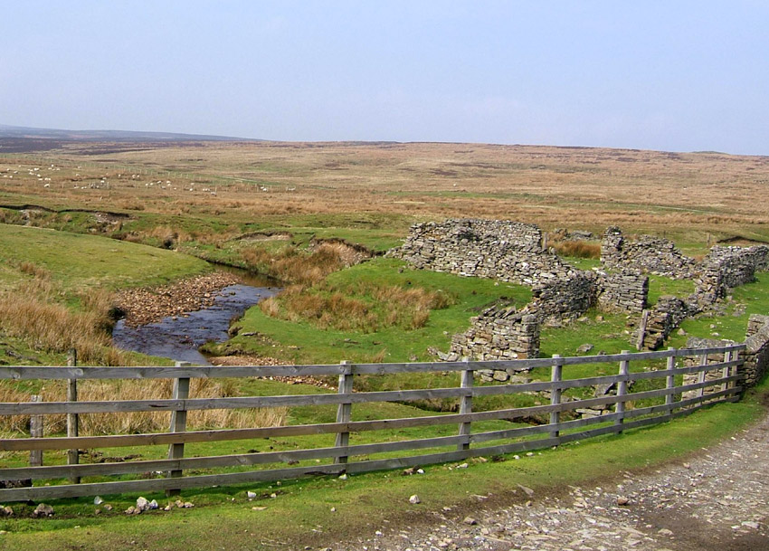
valley, Apedale, past a sheepfold and small farm buildings know as Dent’s
Houses at a junction of tracks. Follow the track directly ahead, climbing
through heather and grouse shooting butts to the Height of Greet, at a cairn and
old mine working.
From the crest of the
hill, some 500 metres above sea level, if the weather is clear, there are
magnificent views over the surrounding moors into Swaledale.
Continue on the main track as it descends and bears right after the
summit, over a stream, eventually joining the Grinton–Redmire road at an
informal parking area.
Straight opposite you will
see a deep, almost dry valley. This is Ridley Hush. Hushing was a popular
technique in lead mining, whereby a narrow stream close or on a main lead vein
was dammed, and after sufficient water had built up behind it,
the dam was released, the scouring action of the water and debris washing
out chunks of galena or lead ore which could be hacked out of the stream bed.
This part of Grinton Moor
is Common Land, enjoying new public access under the CROW Act.
With care, follow a narrow path along the top right hand edge of the
Hush, which descends to a spoil tip. Cross
the beck below the tip to follow the edge of the moor, to emerge at Grinton
Smelt Mill.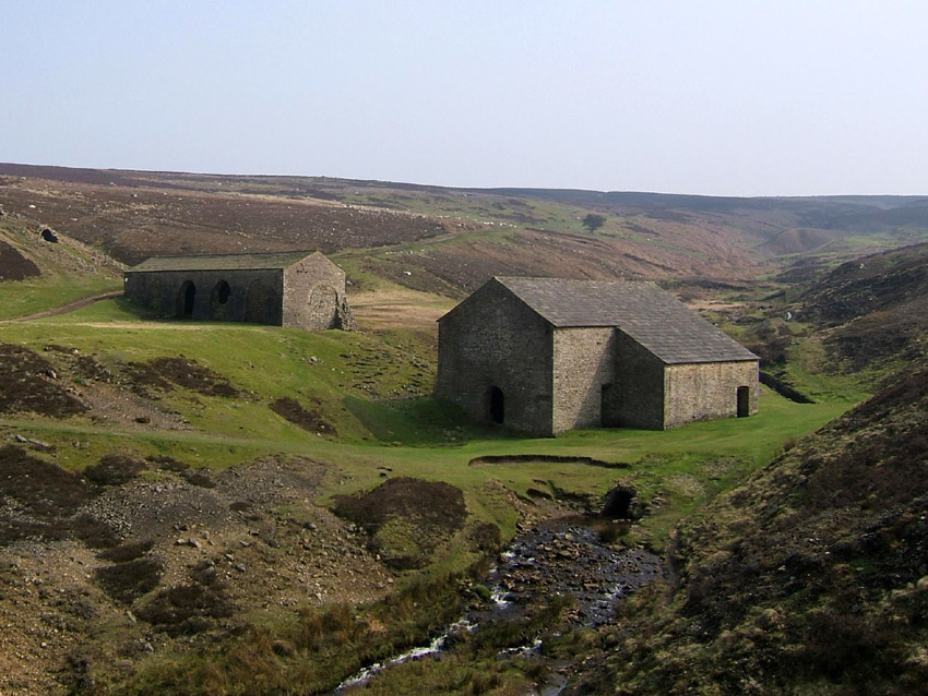
This is perhaps the best
preserved relic of the lead mining industry in the whole of the Yorkshire Dales
– a substantial building with a nearby peat fuel store, and long stone flue
which ascends the hillside, designed to improve the draught in the furnace and
to remove toxic fumes of lead. This
water powered mill was built relatively late in the lead mining era and did not
enjoy a long life of service. Interpretive
boards in the mill explain the history and how it all worked.
Follow a narrow path to
the left hand side of the flue. About half way up look for a path which branches off to the
left, below the scar ahead. This bears left to merge with the bridleway as a
grassy track, heading towards Cogdon Hall, soon crossing the Leyburn-Reeth
roads. Keep ahead for another 300 metres, but where at a gate, follow the footpath (not visible on the ground) which bears
at 45 degrees to the left, descending a shallow stream behind Grinton Lodge
Youth hostel where a little gate and stile leads to a narrow path to the stream
- to be forded with care.
The waymarked path now
leads through fields with a choice of ways into Grinton village, with its
welcoming Bridge Inn.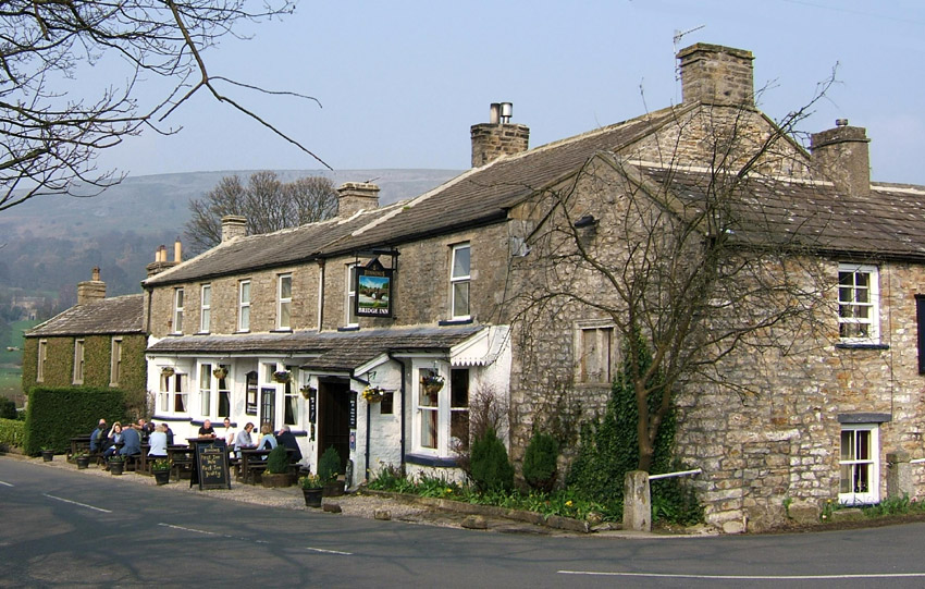 It
is worth spending a little time to admire the 12th century Grinton
Church, before crossing Grinton Bridge and taking the field path past Fremington
to emerge at Reeth.
It
is worth spending a little time to admire the 12th century Grinton
Church, before crossing Grinton Bridge and taking the field path past Fremington
to emerge at Reeth.
Once a focal point for the
lead mining trade, and now a popular centre for visitors, there are few
pleasanter places to end a walk and wait for a bus than Reeth, with its
spectacular views, handsome village green, shops, pubs and cafes.
© Colin Speakman, May 2005. Bus times updated April 2017 - check www.dalesbus.org for updates.